


A tale of Council jumping the gun - again.
- The Beagle

- Oct 15, 2017
- 12 min read
Council manages just over 50 beaches along a coastline that stretches between South Durras Beach and Mystery Bay. They are preparing a Coastal Management Program for these beaches to ensure the Eurobodalla Coast is managed and developed in a way that protects our natural features and supports ongoing growth.
They have engaged Umwelt Environmental Consultants to prepare the Coastal Management Program. The Program will be prepared in accordance with the NSW Coastal Management Act 2016 and new guidelines currently being finalised by the NSW Government. The program’s focus is on areas that are, or are expected to be, affected by coastal hazards now and into the future, with particular attention to places where Council, community or private assets could be at risk from coastal hazards such as erosion and inundation. The program is to be delivered in five stages, with Stages one and two having been completed. Stage 1 was the preparation of a scoping study that identified the key issues and the range technical assessments to be prepared.
Stage two was a technical investigation to identify what areas are potentially at risk from coastal hazards now and in to the future under projected conditions of climate change. These areas have been mapped to indicate the extent of hazards such as erosion and inundation from storms, waves and tides.
Stages 3 has commenced and includes developing strategies to adapt the community to coastal hazards. Council says it intends to work with the community to determine what solutions are preferred advising that, notwithstanding, any solution must be affordable with limited environmental and community impacts.
Stage 4 is to be the public exhibition and certification of the Coastal Management Program. The community will have a final opportunity to comment and contribute during this Stage.
Stage 5 is the to be the monitoring and implementation of the CMP.
In the last week we saw Council hosting three community information sessions to update residents and ratepayers on new mapping that shows how coastal hazards might impact the Eurobodalla in the long term. New mapping shows that 1,000 coastal properties in the Eurobodalla could be at risk of (Coastal) inundation while 150 are potentially facing coastal erosion.
The maps were prepared for Eurobodalla Council’s Coastal Management Program The technical report was prepared by the University of NSW Water Research Laboratory and jointly funded by the NSW Government’s Office of Environmental and Heritage.
It includes maps that will replace the investigation areas identified in Council’s Interim Coastal Hazards Adaptation Code
Council advises that once adopted, the maps will provide certainty to land owners about development on and investment in coastal property and will also remove the need for developers and home builders to conduct coastal hazard studies for individual properties The maps identify 1,000 properties throughout the shire at risk of inundation. Council wrote to owners of those properties inviting them to attend a public information session where they could see the maps and ask questions of Council staff and the consultant. Three information sessions were held.
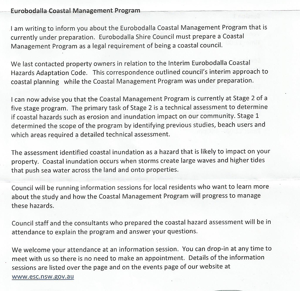
Above: Letter sent by Council to "affected" landowners ✴️
Eurobodalla Mayor Liz Innes encouraged the community to attend the public information sessions, but reminded residents that the Coastal Management Program starts from the position of climate change being accepted, as is required in legislation.
“Whether you believe in climate change or you don’t, the fact of the matter is Council is required to plan for these potential coastal hazards by law,” she said.
“I encourage residents and ratepayers to come along and learn about the issues they will need to consider as a community to make Eurobodalla’s environment, economy and coastal lifestyles more resilient to changing coastal pressures.”
Work on the Coastal Management Program will continue next year when Council will ask the community what options they think should be adopted to manage and protect the coast from the identified hazards. Measures might include engineered hard structures, such as rock walls, pumping sand to prevent erosion, known as beach nourishment, soft engineering that includes constructing new sand dunes or things like planning and development controls.
“We will be seeking feedback from the community next year on these options, however this stage of the project is simply presenting the results of the technical assessment,” Cr Innes said.
A ratepayer (name withheld by Editor) who attended the Long Beach presentation by council for owners that have been classified as vulnerable to coastal hazards by their new study as part of their CMP questioned the Umwelt consultant present as to whether the presentation and study were done according to the principles of the SEPP that Minister Roberts has put on hold. One of the consultants at the presentation confirmed that the mapping and framework of their consultancy was based on a SEPP that the Liberal party has not authorised. A Council staff member then offered the opinion that council had a Ministerial Direction to get a policy in place by 2021 and that, given it had already taken many years and had seen changes in Government and many changes in Ministers Eurobodalla Council were frustrated and were going ahead in anticipation that the SEPP will get through. The questioner reacted with “In other words you anticipate that Minister Roberts and the Liberal Party will commit political suicide”. This comment was in relation to the fact that, as a consequence of being identified as a property at risk by the CMP, the value of those properties will plummet. With the further issue of minimal compensation the CMP threatens the stripping of asset values of over 1000 affected properties in the Eurobodalla that have been identified by the maps generated. Already there have been moves to "reclassify" affected areas as being non-developable and as such this then totally devalues their worth and it is feared that compensation will be adjusted accordingly. To many in the room identifying the cause of the possible innundation was considered a key issue. However at the meeting they were specifically told that the reason why the hazard is occurring (erosion/inundation/etc) was not part of the study and that, as consultants, they were only paid to report on what was happening and not why it was. From others at the meeting we have been advised that UNSW didn't want to enter into the discussion that the works on the southern side of the Clyde were responsible for the beach degredation conditions now present on the northern side and that they were only paid to report on what was actually happening on the northern side of the Clyde as though the two sides of the river had no relevance to the other. A member of the public who attended the meeting informed the Beagle that Council now plan to use the UNSW report of what is 'actually happening' in order to implement Planned Retreat and don't intend to examine the cause. “Therefore, all the mapping was done without any consideration of knowing and mitigating the cause.Trump would say "Bad,Very Bad!"

Above: some minor accretion that appears to be one of the many elephants in the room
So it will be science that determines which properties are affected and, with a wide contour line, the financial livelihoods of Eurobodalla home owners will be determined. So what is this science? The Water Research Laboratory (WRL) of the School of Civil and Environmental Engineering at UNSW Sydney was engaged by Umwelt Australia (Umwelt) to prepare a Coastal Hazard Assessment to support a Coastal Management Program for Eurobodalla Shire Council (ESC). The study was originally commissioned in 2011 to examine beaches within Batemans Bay only. In 2012, the scope of the study was extended to the wider local government area. In 2013, the study was put on hold while a sea level rise policy and planning framework were prepared, additional photogrammetric, topographic and bathymetric datasets were collected and the NSW Government undertook coastal reforms. The study was re-commissioned with a modified scope and alternative methodologies in December 2016. The methodology applied in this report for the Eurobodalla Coastal Hazard Assessment was developed in consultation with ESC and the NSW Office of Environment and Heritage (OEH) and considers the following documents: • NSW Coastal Management Act (2016) ; • Draft NSW Coastal Management Manual (OEH, 2016); • Coastal Risk Management Guide (DECCW, 2010); • ESC sea level rise policy and planning framework (ESC, 2014;Whitehead & Associates, 2014); • NSW Coastline Management Manual (NSW PWD, 1990) While it is a very detailed, scientifically based, document the Eurobodalla Coastal Hazard Assessment report (June 2017) ( http://bit.ly/2yLsIOQ ) very clearly states that: The Water Research Laboratory shall not assume any responsibility or liability whatsoever to any third party arising out of any use or reliance on the content of this report. It is noted however that the Water Research Laboratory document took a lead roll in the presentation by council to a "third party", the community who will in fact bear the full brunt of the responsibility and liabiity as a consequence of their science being adopted. "Now that isn’t very reassuring" says our resident. At the public meeting last week, when asked what the consequences were of being an identified block a Council staff member advised that there would be little immediate effect however, when pressed, was forced to admit to the fact that the Department of Planning and Environment, having recently issued a Planning Circular (PS 16-003) on the Coastal Management SEPP, that based on that advice clarified that where land is partly or wholly mapped by the draft Coastal Management SEPP, a planning certificate issued for that land should record that the draft SEPP applies to that land. It is by that recognition of their adopted level that they could then interpolate that level across all the "affected" properties and extrapolate out 6000 properties and then separate them into Coastal and Estuary. The properties are identified and they are labled as tainted. "They may as well go around and paint a yellow triangle on the door and tell the people that their homes are now devalued because the sea level rise is coming and they will eventually see their properties consumed by the sea."
Note that under the Guidelines for Preparing Coastal Zone Management Plans Councils are to categorise all private property subject to coastal hazards according to the degree of the hazard, and, in the case of hazards due to erosion and recession, the category of council’s intended response to managing the risks to the property. This information is to be provided in a table in the CZMP. Where a property is located on the boundary between two hazard areas, the most seaward hazard area should be used, unless this area is less than approximately 25% of the block.
Let’s look at the statement by Council again: The methodology applied in this report for the Eurobodalla Coastal Hazard Assessment was developed in consultation with ESC and the NSW Office of Environment and Heritage (OEH) and considers the following documents: • NSW Coastal Management Act (2016) ; • Draft NSW Coastal Management Manual (OEH, 2016); Coastal Management Act 2016: The Coastal Management Act 2016 provides the architecture for strategic management of our coastal areas into the future. When the Act commences, the new Act will replace the current Coastal Protection Act 1979.
That’s right – the Act hasn’t been formally adopted. Why? Many believe that because a 'cornerstone' of Liberal Party policy is property rights, given the threat that the 'proposed' SEPP (State Environmental Planning Policy) poses to property rights the government might be having second thoughts. Minister Roberts assured the NSW Coastal Alliance(NCA) that he would strongly oppose the SEPP in its current form. He then put a 'hold' on the SEPP in late 2016 and has still 'held his ground' and the SEPP still can't get through nearly a year later. However, that doesn’t appear to phase Eurobodalla Council as they continue to spend considerable funds on proceeding with the principles of an unadopted SEPP while adhering to all its guidelines. By showing the new maps ( based of the 'stopped' SEPP) to the public, without advising the public that the SEPP has not been adopted, Council are, if fact, creating the illusion to the public that the NSW Liberal Govt has all but forsaken property rights and have authorised the SEPP along with all of its accompanying documentation, process and consequences. And that is NOT the case. There also appears to be considerable Council confusion elsewhere as to whether the Act has been adopted or not. In the recent submission ( http://bit.ly/2gj7qAK ) by Council to the RMS in regards to the new Batemans Bay bridge it states: Wharf Road has been identified by the NSW Government as a coastal erosion hot-spot. Council has prepared a Coastal Zone Management Plan (CZMP) for this precinct that will guide how the erosion hazard is managed. The plan is currently with the Minister for Environment awaiting certification under the NSW Coastal Management Act 1979. The key action in the plan is for the NSW Government to purchase private land that is at immediate and ongoing risk from coastal erosion and shoreline recession. NSW Department of Planning will be responsible for this action and have endorsed the CZMP prior to Council seeking certification from the Minister. When implemented, this will provide public open space that can also be utilised as a buffer to manage public infrastructure. Once the land is in public ownership, Council will have options on how to maintain access to the Wharf Road area. Management options include:
a. Consolidate access and future works expenditure to the sections of Wharf Road that are not at risk from erosion
b. Allow the existing connection to Peninsula Drive to erode and rely on the lower maintenance access from the Princes Highway
c. Consolidate future development behind areas that are protected by existing rock walls.
Closing the Princes Highway access will restrict management of the hazard to maintaining the Peninsula Drive access. This will represent a significant cost to Council as the works will need to mitigate against coastal erosion and coastal inundation over the design life of the asset and beyond. Works would need to include:
a. Design and construct 450 to 500m section of rock wall to design life that meets sea level rise projections beyond 2100
b. Back fill corresponding section of rock wall
c. Design and construct section of Wharf Road to new landform alignment
d. Remove, relocate and replace associated services behind new works. It has been noted that at the bottom of http://projects.umwelt.com.au/Eurobodalla/ page it says North Batemans Bay (Wharf Road) is already included in a certified CZMP (2017), as directed by the Minister for Planning. We have engaged Umwelt Environmental Consultants to prepare the Coastal Management Program. The Program will be prepared in accordance with the NSW Coastal Management Act 2016 and new guidelines currently being finalised by the NSW Government. The CMP will meet the requirements of the Coastal Management Act 2016, the Coastal Management SEPP and the new coastal Manual. The present status (as at: 21/08/2017) is that the Office of Environment and Heritage is currently finalising the Coastal Management Manual and a Toolkit of technical resources and advice for coastal managers. Source
This is only the beginning of the building public outcry as residents become more aware of the politics that has been witnessed to date by both Council and by the State Government. Our informing citizen told the Beagle: "Some quotes from the actual UNSW study suggest that the UNSW knows that erosion on the North is a result of works on the South, regardless of what they were paid to say. “In section 2.12 Corrigans Beach it states:
Corrigans Beach is a 1.8 km long artificially accreted beach with a low gradient facing north-east This beach commences at the eastern end of the Boat Harbour training wall. Construction of the training wall was initially completed in 1905 but it was extended eastward in 1991 “I note that they left out the building of the bridge in the 50s and the building of the revetment wall from the CBD to Hanging rock in the 1960s that has been confirmed by the contractor who was involved in doing the work. By ignoring these works, they give the illusion that it happened over 110 years). As a result of both these works, sand accumulated on the southern side of the training wall, accreting the shoreline by up to 600 m since 1905 (or 300m since 1960) to form Corrigans Beach.” “The NSW report has some very questionable science and assumptions and that science and those assumptions, if accepted and adopted, will see considerable and unnecessary impact on ratepayers assets as their homes are devalued.” “While Council says in this round that only 1000 properties have been identified we have to remember that there are in fact 6000 properties however Council has now cleverly separated them into Coastal and Estuary to lessen the public intensity as they begin the process of implementing their own agenda because, until the NSW government adopts the SEPP that is all it is – a Eurobodalla Council Agenda under the cloak of being sanctioned by the government. "Up and down the East Coast of Australia communities are begin to rally and to challenge the government on their policies and their science. There are over 100,000 properties affected by the yet to be adopted Act that has been placed in limbo by the Liberal NSW Government. “We need to also be looking at why Eurobodalla has been so hell bent on pushing through Planning NSW agendas. For one reason or another, we are still the guinea pigs for NSW Planning Environmental policy. Remember that we were the first to try to implement the Hot Zones, LEP modifications, Environmental Overlays, Biocertification and Sea Level Rise. The general belief appears to be that if you can get it through Eurobodalla Council then it establishes a precedent to press it through the rest of the NSW Councils. "Why, because for one, we have an inattentive Council who simple trust the word of their staff and endorse the studies, reports and policies put before them with little if any questioning. They rubber stamp the budgets to undertake the consultant reports and endorse the salaries of the staff to pursue their planning agendas and in this case, they are endorsing the staff to carry out public sessions that are advising and alarming residents about a change on the NSW Planning SEPP that has been suspended and unlikely to proceed with major questions now raised on both the science and the social and financial consequences of affected residents as well as placing at serious threat the re-election of the Liberal Party if they endorse the Act". "And sadly the community at large and our Councillors are none the wiser".